Archaeology offers a window into how the Reconquista reshaped daily life across the Iberian countryside. Excavations in Valencia and Granada reveal how irrigation systems, farming communities, and fortified villages adapted as Christian rule spread south — transforming centuries of Islamic rural culture into a new medieval landscape.
By Luke Gauci
The history, culture, geography and climate of the Iberian Peninsula are varied. The climates of modern-day Spain and Portugal, which face the Mediterranean and the Atlantic, respectively, are significantly different and must be factored in. While northern and north-western regions, like Santiago de Compostela, experience an oceanic damp climate, southern and south-eastern regions, such as Valencia and Granada, have a much drier Mediterranean climate. Furthermore, the proximity of Islamic Valencia and Granada to Islamic North Africa also results in a variation in the material culture compared to the Christian north. Therefore, the implementation of cultural influences from the early Islamic period historically differs from those of later Christian influences.
As the article below will indicate, as the Christian advance moved south between the 12th and 15th centuries, European influences on these regions began to grow, altering the use of material culture within the rural context. This brought such regions closer to ‘western’ European styles rather than Islamic. These European influences ultimately varied between the two regions, as Granada was ‘Islamised’ for a much longer period than Valencia. Therefore, even within the same period (12th-15th century), the surviving material culture of Granada is different to that of Valencia, mainly due to their respective falls to Christendom in 1238 and 1492.
This research, which formed part of my undergraduate dissertation, focuses on the archaeology of the rural cultural changes of Valencia and Granada as they developed culturally and historically throughout the Reconquista. This will be done by focusing on how the general agriculture of the regions functioned while simultaneously highlighting the development and eventual abandonment of rural settlements by Mudejar (Islamic-oriented) around these agricultural centres. Ultimately, the research highlights the above-mentioned factors about rural cultures to provide a clearer understanding of the everyday life of these communities and how their historical development has affected the regions.
Agriculture and Rural Settlements
It is essential to bear in mind that written sources describing the rural landscape of Iberia, in particular in the south and south-east, are very fragmented. The majority of our current knowledge about the rural landscape comes from Christian land registers, which date to the 12th and 13th centuries. As a result, reconstructing an understanding of the rural landscape is slow-going. However, it is still possible to achieve this by using archaeological data to support the claims of these surviving written records. With both, it is possible to gain a deeper understanding of the everyday functions and layout of these settlements.
1. Agriculture and Irrigation Systems
Fig 1 – Plans of the irrigated fields on the Fawara Canal, Valencia. Retrieved from Thomas F. Glick, Irrigation and Society in Medieval Valencia (Cambridge: Belknap Press of Harvard University Press, 1970), p. 16.
Arabic writers from the medieval period indicates that two types of agricultural land co-existed within the general agricultural system of al-Andalus. These were irrigated land and dry land, both of which provided different crops, such as olive trees, raisins, dates, and other crops. A critical component in Muslim agriculture was the irrigation systems built to combat the arid Mediterranean climate of south-eastern Iberia. Archaeological excavations have shown that these irrigation systems were particularly prominent in Valencia (Fig. 1), where river and natural spring waters from the mountains and valleys were channelled through a system of dams and canals. The water flow was directed to agricultural land, livestock water supply, and settlements throughout the region (Fig. 2).
Fig. 2: Plans of irrigated fields on the Benifurt Canal Jativa, Valencia Region. Retrieved from Glick, p.17
The water irrigation systems in Valencia were an integral part of maintaining the agricultural-based economy. At the same time, the importance of traditional dry land farming was also critical. Yet, these irrigation systems, built in the 11th century, continued to contribute to agricultural output and remained in use after the Christian conquest (Fig. 3).
Fig 3. – The water channel in the historical irrigation system at the Horta of Valenia – photo by FA0 of the United Nations
The influx of Christian settlers to these areas shifted rural society drastically. Over an approximate 20-year period (1233-1258), the Crown of Aragon undertook a program of reorganising land and settlements by introducing the feudal system, which divided both irrigated and dry lands among the population. Christian families swarmed the many water irrigation systems, which were considered lucrative properties (Fig. 3). As a result, this pushed out Mudejar communities, forcing them to settle on rural land in the more mountainous areas, leaving the more fertile plains to the incoming Christian populations.
However, within the Crown of Aragon, including Valencia, this new Christian land was worked by both Christian and Mudejar communities. This co-existence also existed in Nasrid, and later Christian, Granada. Here, Christian land registers indicate that mixed communities worked the land in similar ways to 13th-century Valencia. However, in this case, there was a higher Mudejar population in the rural setting, mainly due to Granada’s prolonged existence as an Islamic emirate.
Therefore, evidence shows that in both cases, peasant communities worked the rural land for the ruling Christian lords or chiefs. However, in the case of post-conquest Valencia, the more ‘urbanised’ areas of the general rural landscape were left to incoming Christian communities. Simultaneously, in Granada, the incoming Mudejars required existing villages to grow, resulting in the eradication of tribe-oriented communities.
2. The Evolution of Villages in General
In post-conquest Valencia and Granada, this shift and eventual expulsion of Mudejar communities left many abandoned rural settlements. This gives a better understanding of how these communities grew and adapted between the 10th and 14th centuries. Archaeological excavation has shown there were three variations: undefended villages, fortified villages and fortified villages on hilltops. In general, villages varied in size and economic importance depending on the land available for cultivation. In most cases, the agricultural land varied between 100ha and 500ha. This determined the size of the available workforce within villages, its economic importance and, indirectly, the likelihood of the village being targeted by Christian raiders. Therefore, in some cases, defensive structures must also be factored in for the more lucrative settlement targets.
Most villages between the 8th and 11th centuries were small hamlets, sometimes centred around a small mosque, with approximately ten houses populated by specific tribes. These examples tended to be undefended because, at the height of al-Andalus, there was usually no need for permanent defences since there was no immediate military threat. There are examples of this kind of undefended villages in Bollullos de la Mitación, Seville.
However, the rise of Christian raids into al-Andalus forced these undefended villages to adapt to their new situation. This was achieved with the construction of fortifications and towers for defence. Christian land registers indicate that in Nasrid Granada, by the 13th century, villages could have expanded to include up to fifty houses, with defences in place. Below are two examples: a fortified village and a fortified village on a hilltop, both located in the Valencia and Granada regions, respectively.
3. Torre Bofilla, Bétera, Valencia region
Fig 4. – Ruins of Torre Bofilla, Betera, Valencia Region. Retrieved from Valor and Garcia Camino, p.18.
One of the very few extensively excavated examples of a fortified rural settlement is Torre Bofilla in Bétera, within the Valencia region, which was occupied from the 11th to the 14th century, first as an undefended hamlet, and later, with added fortifications (Fig. 4). The Torre Bofilla defences (see red outline on Map 1) contains a central defensive tower and was enclosed with a wall system.
While there are no preserved Islamic descriptions of how the defence systems functioned, later Christian accounts describe the village as having a triple wall system. The first was the inner wall around the main central tower, both of which survive. This was constructed from masonry and earth ramparts (Fig. 5), and its outer fortification was used to protect livestock during an attack.
Fig 5. – Central tower of Torre Bofilla, Betera, Valencia Region
These were followed by the second most outer wall, constructed of masonry, and was the defence wall for the main village (Map 1), and the outermost wall, which the archaeology indicates was not entirely completed and was possibly used as a first line of defence for the more vulnerable sections of the village. The outer and middle walls are heavily degraded, with not much surviving in the archaeological record. However, Map 1 shows that the extent of the defences that existed is significant, with the overall village covering a large surface area (40,000 m2). Yet, the stratigraphy indicates it was reduced to 18,000 m2 in the 14th century before being abandoned and dismantled.
Further, it must be emphasised that these defences were not temporary structures; instead, the danger posed by Christian raiders coming into al-Andalus in the 12th/13th centuries necessitated permanent defences. Therefore, Torre Bofilla shows that these defences were integrated into the everyday lives of the communities, serving as a form of security for their livelihoods under Islamic leadership.
Excavations within the main village revealed thirty-four houses, with ten examples extensively excavated. From these, it has been determined that a standard rural house contains three sections. A standard Islamic courtyard, a living area with two adjoining rooms on the eastern side and an auxiliary area with workshops and stables on the western side. Further, all the dwelling examples excavated at Torre Bofilla show evidence of an oven either in the courtyard or within the living area on the eastern side.
Fig 6 – Block of houses from Torre Bofilla (shaded areas are the exterior courtyards). Retrieved from Avelino Guirrez and Valor, p. 79.
These examples of village houses indicate that they are not as grand as those found in urban cities like Valencia or Granada themselves. However, the layout of these homes is similar, as they still had to follow Islamic law codes, such as where to direct smoke and how to manage the drainage of water and waste. Emphasis was placed on the privacy of the family, particularly the women, within the home. As a result, most houses had an ‘L-shaped’ corridor that concealed the interior and lacked front windows; however, the design of these buildings varied. Therefore, a number of these features differ in the rural context, such as the use of the courtyard as a cooking/garden space (Fig. 6 – Shaded area). Excavations also revealed a public bath and four wells within the confines of the village.
4. El Castillejo, Los Guajares, Granada region
We find an example of a fortified hilltop settlement, El Castillejo in Los Guajares, within the Granada region. Built on a 400m high hilltop plateau, various archaeological excavations between the early 1980s and 2016 revealed that it was inhabited between the 11th and the early 14th century before being abandoned. The reason for the abandonment is unclear. However, recent studies have suggested the potential for severe earthquake damage. The eastern side shows signs of destruction due to earthquake damage. Excavations from 2015 indicate signs of damage to the western half of the village, with extensive repairs above it. Therefore, the issue of earthquake damage, making certain sections of the village uninhabitable must not be entirely ruled out. It must also be considered that, due to the earthquake damage, the settlement may not have been able to accommodate the incoming Mudejar populations, resulting in its eventual abandonment.
Map 2 – Plan view of El Castilejo, Granada Region. Retrieved from Avelino Guierrez and Valor (b), p. 156.
The village was surrounded by an oval-like masonry wall, similar in description to the secondary wall at Torre Bofilla, that circles an area of about 15,000 m2 with a single gate on the western side, three small towers (Map 2), a small 3.05 ha irrigation system, similar to those found in the Valencian region, and 4.2 ha of dry agricultural land typical for the size of the village. The village is divided into two sections, ‘north’ and ‘south’, by a main road (Map 2). During excavations, thirty houses have been noted, along with a small number of other buildings that may have functioned as stables or granaries, due to their shape and the lack of material culture found within them. The domestic houses on either side of the main street are of two types. In the northern section, there are several ‘L-shaped’ houses similar to those at Torre Bofilla. However, within the southern section, ‘U-shaped’ houses with four or five rooms are found.
It has been suggested that the differences in design and the quality of ceramics excavated in both sections of the village could be linked to a social hierarchy within the community. This may indicate that the slightly wealthier peasants inhabited the northern half, while the poorer families lived in the southern half. However, due to the lack of written records describing the village, the archaeology alone cannot guarantee this. One cannot rely on Castilian documentation, as if the village was truly abandoned in the 14th century, the site was long abandoned by the conquest of Granada between 1482 and 1492.
Legacies of the Reconquista
Based on the evidence presented in the case studies above, the importance of agriculture and its role in aiding community life is evident. The similarities between the architecture and the general way of life for these communities are fascinating to uncover and shows that rural life and its mechanisms were far more complex than simply cultivating crops for a lord or chief. Unfortunately, due to the circumstances of the Christian conquests, many of these rural settlements did not survive, or if they did, not for long, possibly due to the migration of Mudejar communities in the Christian context, which ultimately overwhelmed a number of these villages and limited their resources, forcing their eventual abandonment.
It is here that the local scenario intertwines with the broader political context, as the abandonment of rural communities is linked to the consequences of larger events. Hence, as the specific examples given above illustrate, archaeology highlights that the symbolic and eventual physical transformation of the topography, which occurred at different rates, was ultimately intended to demonstrate Christian supremacy and overshadow the ‘eastern’ Islamic culture, thereby strengthening the already present ‘western’ European culture. The strength of ‘western’ European culture forcibly transformed a region that had strong ties to the Islamic world for centuries.
Luke Gauci is a graduate of the University of Malta, where he read for his undergraduate honours degree in European and Global History with Archaeology, specialising in the medieval period. He is currently reading for his masters degree in European and Global History at the University of Malta, working on the long term impact of the Fourth Crusade and the Latin Empire on the Eastern Roman Empire (1200-1400).
Archaeology offers a window into how the Reconquista reshaped daily life across the Iberian countryside. Excavations in Valencia and Granada reveal how irrigation systems, farming communities, and fortified villages adapted as Christian rule spread south — transforming centuries of Islamic rural culture into a new medieval landscape.
By Luke Gauci
The history, culture, geography and climate of the Iberian Peninsula are varied. The climates of modern-day Spain and Portugal, which face the Mediterranean and the Atlantic, respectively, are significantly different and must be factored in. While northern and north-western regions, like Santiago de Compostela, experience an oceanic damp climate, southern and south-eastern regions, such as Valencia and Granada, have a much drier Mediterranean climate. Furthermore, the proximity of Islamic Valencia and Granada to Islamic North Africa also results in a variation in the material culture compared to the Christian north. Therefore, the implementation of cultural influences from the early Islamic period historically differs from those of later Christian influences.
As the article below will indicate, as the Christian advance moved south between the 12th and 15th centuries, European influences on these regions began to grow, altering the use of material culture within the rural context. This brought such regions closer to ‘western’ European styles rather than Islamic. These European influences ultimately varied between the two regions, as Granada was ‘Islamised’ for a much longer period than Valencia. Therefore, even within the same period (12th-15th century), the surviving material culture of Granada is different to that of Valencia, mainly due to their respective falls to Christendom in 1238 and 1492.
This research, which formed part of my undergraduate dissertation, focuses on the archaeology of the rural cultural changes of Valencia and Granada as they developed culturally and historically throughout the Reconquista. This will be done by focusing on how the general agriculture of the regions functioned while simultaneously highlighting the development and eventual abandonment of rural settlements by Mudejar (Islamic-oriented) around these agricultural centres. Ultimately, the research highlights the above-mentioned factors about rural cultures to provide a clearer understanding of the everyday life of these communities and how their historical development has affected the regions.
Agriculture and Rural Settlements
It is essential to bear in mind that written sources describing the rural landscape of Iberia, in particular in the south and south-east, are very fragmented. The majority of our current knowledge about the rural landscape comes from Christian land registers, which date to the 12th and 13th centuries. As a result, reconstructing an understanding of the rural landscape is slow-going. However, it is still possible to achieve this by using archaeological data to support the claims of these surviving written records. With both, it is possible to gain a deeper understanding of the everyday functions and layout of these settlements.
1. Agriculture and Irrigation Systems
Arabic writers from the medieval period indicates that two types of agricultural land co-existed within the general agricultural system of al-Andalus. These were irrigated land and dry land, both of which provided different crops, such as olive trees, raisins, dates, and other crops. A critical component in Muslim agriculture was the irrigation systems built to combat the arid Mediterranean climate of south-eastern Iberia. Archaeological excavations have shown that these irrigation systems were particularly prominent in Valencia (Fig. 1), where river and natural spring waters from the mountains and valleys were channelled through a system of dams and canals. The water flow was directed to agricultural land, livestock water supply, and settlements throughout the region (Fig. 2).
The water irrigation systems in Valencia were an integral part of maintaining the agricultural-based economy. At the same time, the importance of traditional dry land farming was also critical. Yet, these irrigation systems, built in the 11th century, continued to contribute to agricultural output and remained in use after the Christian conquest (Fig. 3).
The influx of Christian settlers to these areas shifted rural society drastically. Over an approximate 20-year period (1233-1258), the Crown of Aragon undertook a program of reorganising land and settlements by introducing the feudal system, which divided both irrigated and dry lands among the population. Christian families swarmed the many water irrigation systems, which were considered lucrative properties (Fig. 3). As a result, this pushed out Mudejar communities, forcing them to settle on rural land in the more mountainous areas, leaving the more fertile plains to the incoming Christian populations.
However, within the Crown of Aragon, including Valencia, this new Christian land was worked by both Christian and Mudejar communities. This co-existence also existed in Nasrid, and later Christian, Granada. Here, Christian land registers indicate that mixed communities worked the land in similar ways to 13th-century Valencia. However, in this case, there was a higher Mudejar population in the rural setting, mainly due to Granada’s prolonged existence as an Islamic emirate.
Therefore, evidence shows that in both cases, peasant communities worked the rural land for the ruling Christian lords or chiefs. However, in the case of post-conquest Valencia, the more ‘urbanised’ areas of the general rural landscape were left to incoming Christian communities. Simultaneously, in Granada, the incoming Mudejars required existing villages to grow, resulting in the eradication of tribe-oriented communities.
2. The Evolution of Villages in General
In post-conquest Valencia and Granada, this shift and eventual expulsion of Mudejar communities left many abandoned rural settlements. This gives a better understanding of how these communities grew and adapted between the 10th and 14th centuries. Archaeological excavation has shown there were three variations: undefended villages, fortified villages and fortified villages on hilltops. In general, villages varied in size and economic importance depending on the land available for cultivation. In most cases, the agricultural land varied between 100ha and 500ha. This determined the size of the available workforce within villages, its economic importance and, indirectly, the likelihood of the village being targeted by Christian raiders. Therefore, in some cases, defensive structures must also be factored in for the more lucrative settlement targets.
Most villages between the 8th and 11th centuries were small hamlets, sometimes centred around a small mosque, with approximately ten houses populated by specific tribes. These examples tended to be undefended because, at the height of al-Andalus, there was usually no need for permanent defences since there was no immediate military threat. There are examples of this kind of undefended villages in Bollullos de la Mitación, Seville.
However, the rise of Christian raids into al-Andalus forced these undefended villages to adapt to their new situation. This was achieved with the construction of fortifications and towers for defence. Christian land registers indicate that in Nasrid Granada, by the 13th century, villages could have expanded to include up to fifty houses, with defences in place. Below are two examples: a fortified village and a fortified village on a hilltop, both located in the Valencia and Granada regions, respectively.
3. Torre Bofilla, Bétera, Valencia region
One of the very few extensively excavated examples of a fortified rural settlement is Torre Bofilla in Bétera, within the Valencia region, which was occupied from the 11th to the 14th century, first as an undefended hamlet, and later, with added fortifications (Fig. 4). The Torre Bofilla defences (see red outline on Map 1) contains a central defensive tower and was enclosed with a wall system.
While there are no preserved Islamic descriptions of how the defence systems functioned, later Christian accounts describe the village as having a triple wall system. The first was the inner wall around the main central tower, both of which survive. This was constructed from masonry and earth ramparts (Fig. 5), and its outer fortification was used to protect livestock during an attack.
These were followed by the second most outer wall, constructed of masonry, and was the defence wall for the main village (Map 1), and the outermost wall, which the archaeology indicates was not entirely completed and was possibly used as a first line of defence for the more vulnerable sections of the village. The outer and middle walls are heavily degraded, with not much surviving in the archaeological record. However, Map 1 shows that the extent of the defences that existed is significant, with the overall village covering a large surface area (40,000 m2). Yet, the stratigraphy indicates it was reduced to 18,000 m2 in the 14th century before being abandoned and dismantled.
Further, it must be emphasised that these defences were not temporary structures; instead, the danger posed by Christian raiders coming into al-Andalus in the 12th/13th centuries necessitated permanent defences. Therefore, Torre Bofilla shows that these defences were integrated into the everyday lives of the communities, serving as a form of security for their livelihoods under Islamic leadership.
Excavations within the main village revealed thirty-four houses, with ten examples extensively excavated. From these, it has been determined that a standard rural house contains three sections. A standard Islamic courtyard, a living area with two adjoining rooms on the eastern side and an auxiliary area with workshops and stables on the western side. Further, all the dwelling examples excavated at Torre Bofilla show evidence of an oven either in the courtyard or within the living area on the eastern side.
These examples of village houses indicate that they are not as grand as those found in urban cities like Valencia or Granada themselves. However, the layout of these homes is similar, as they still had to follow Islamic law codes, such as where to direct smoke and how to manage the drainage of water and waste. Emphasis was placed on the privacy of the family, particularly the women, within the home. As a result, most houses had an ‘L-shaped’ corridor that concealed the interior and lacked front windows; however, the design of these buildings varied. Therefore, a number of these features differ in the rural context, such as the use of the courtyard as a cooking/garden space (Fig. 6 – Shaded area). Excavations also revealed a public bath and four wells within the confines of the village.
4. El Castillejo, Los Guajares, Granada region
We find an example of a fortified hilltop settlement, El Castillejo in Los Guajares, within the Granada region. Built on a 400m high hilltop plateau, various archaeological excavations between the early 1980s and 2016 revealed that it was inhabited between the 11th and the early 14th century before being abandoned. The reason for the abandonment is unclear. However, recent studies have suggested the potential for severe earthquake damage. The eastern side shows signs of destruction due to earthquake damage. Excavations from 2015 indicate signs of damage to the western half of the village, with extensive repairs above it. Therefore, the issue of earthquake damage, making certain sections of the village uninhabitable must not be entirely ruled out. It must also be considered that, due to the earthquake damage, the settlement may not have been able to accommodate the incoming Mudejar populations, resulting in its eventual abandonment.
The village was surrounded by an oval-like masonry wall, similar in description to the secondary wall at Torre Bofilla, that circles an area of about 15,000 m2 with a single gate on the western side, three small towers (Map 2), a small 3.05 ha irrigation system, similar to those found in the Valencian region, and 4.2 ha of dry agricultural land typical for the size of the village. The village is divided into two sections, ‘north’ and ‘south’, by a main road (Map 2). During excavations, thirty houses have been noted, along with a small number of other buildings that may have functioned as stables or granaries, due to their shape and the lack of material culture found within them. The domestic houses on either side of the main street are of two types. In the northern section, there are several ‘L-shaped’ houses similar to those at Torre Bofilla. However, within the southern section, ‘U-shaped’ houses with four or five rooms are found.
It has been suggested that the differences in design and the quality of ceramics excavated in both sections of the village could be linked to a social hierarchy within the community. This may indicate that the slightly wealthier peasants inhabited the northern half, while the poorer families lived in the southern half. However, due to the lack of written records describing the village, the archaeology alone cannot guarantee this. One cannot rely on Castilian documentation, as if the village was truly abandoned in the 14th century, the site was long abandoned by the conquest of Granada between 1482 and 1492.
Legacies of the Reconquista
Based on the evidence presented in the case studies above, the importance of agriculture and its role in aiding community life is evident. The similarities between the architecture and the general way of life for these communities are fascinating to uncover and shows that rural life and its mechanisms were far more complex than simply cultivating crops for a lord or chief. Unfortunately, due to the circumstances of the Christian conquests, many of these rural settlements did not survive, or if they did, not for long, possibly due to the migration of Mudejar communities in the Christian context, which ultimately overwhelmed a number of these villages and limited their resources, forcing their eventual abandonment.
It is here that the local scenario intertwines with the broader political context, as the abandonment of rural communities is linked to the consequences of larger events. Hence, as the specific examples given above illustrate, archaeology highlights that the symbolic and eventual physical transformation of the topography, which occurred at different rates, was ultimately intended to demonstrate Christian supremacy and overshadow the ‘eastern’ Islamic culture, thereby strengthening the already present ‘western’ European culture. The strength of ‘western’ European culture forcibly transformed a region that had strong ties to the Islamic world for centuries.
Luke Gauci is a graduate of the University of Malta, where he read for his undergraduate honours degree in European and Global History with Archaeology, specialising in the medieval period. He is currently reading for his masters degree in European and Global History at the University of Malta, working on the long term impact of the Fourth Crusade and the Latin Empire on the Eastern Roman Empire (1200-1400).
Click here to download a PDF version of this article, which includes footnotes
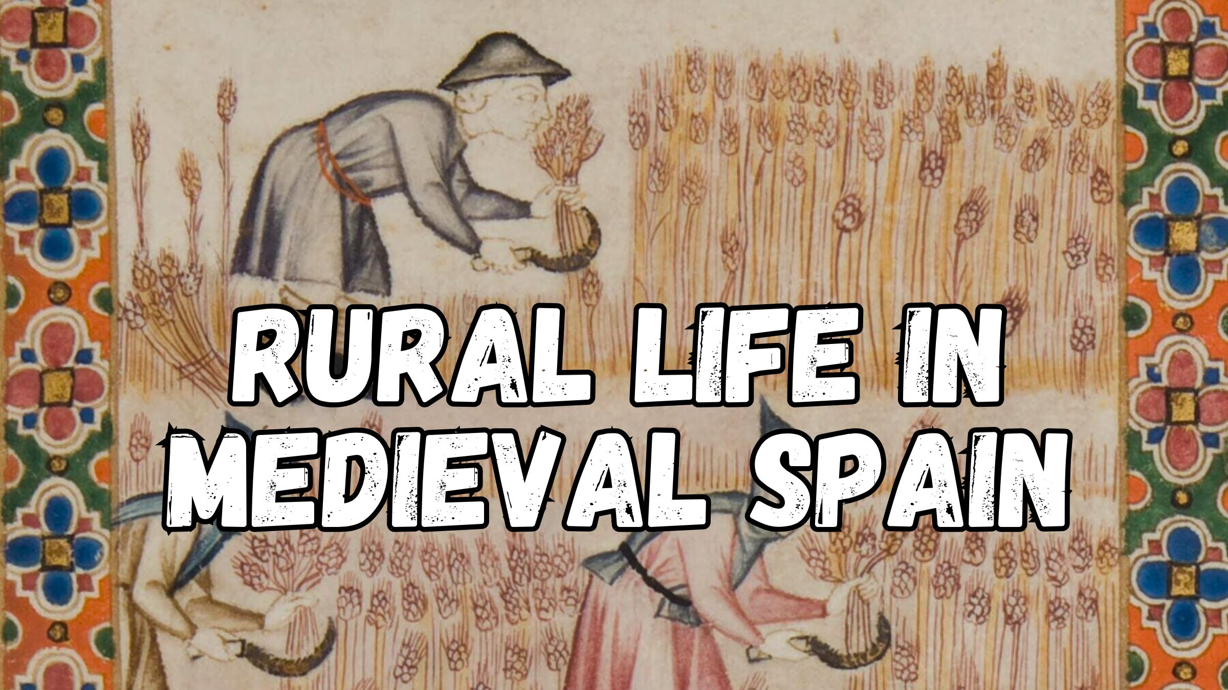
Top Image: Agriculture from a 13th-century Iberian manuscript – Cántigas de Santa María in the Rich Manuscript from Florence – Wikimedia Commons
Subscribe to Medievalverse
Related Posts